

This will be a post with minimal processing and maximum pictures. We spent several hours here and I blazed away. Of course I put a horse out :) you will see her in the last 5 shots. To start with, the word "malpais" is pronounced 'mal-pie' and means, literally, bad place.


Seen on satellite, the Carrizozo Lava Field looks like a pair of slender black wings, 42 miles from end to end. It's northeast of White Sands Missile Range and of the White Sands. I had seen the word malpais in western literature, but hadn't realized what it meant.

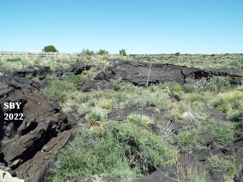
Geologists say the flow of lava is around 5,000 years old. It is the youngest flow in the continental United States by a long shot. See that tiny bump on the left horizon below? That's supposed to be the source,...

The paved trail was very nice, switchbacking down the hill into the lava field.

My husband photographed flowers, but I was taken by all the textures of the rock.


I started saying to myself, "There is no way I would ever take a horse across this!"

To think this rock had once been squeezy and soft, bulging itself into ripples and ropes, curls and crescents. What was 5,000 years, after all?
The pine trees on the horizon here marked the half way point of the trail.


A desert environment, this was somewhat lush after the summer monsoon. This was September, enjoying the rains from July and August.
There were cracks, miniature canyons, lumps and bumps and holes. I couldn't see how any hoofed animal could travel far.

A couple of closer shots, for texture. Those are barrel cactuses in the upper left.


Never mind it was a public place, with tremendous visibility. I had a bridled (o.k. hackamore'd) horse with me and there were few hikers, giving long stretches of privacy. This mare, the wife of my Carrizozo [Nikolas], was still finalizing a name that day.

Alas for unshod hooves on that hard rock!
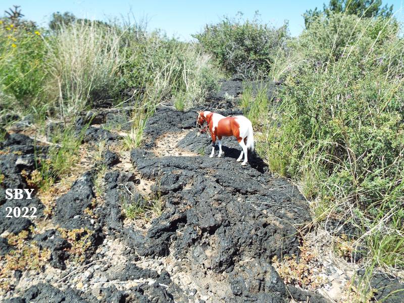
The wind was light, no damage was sustained, other than to my reputation when strangers came by.


Much later the mare would be named Salorcha. At the time I think it was Cocobeau.

You really need a good horse out on the malpais.
I love this story!
ReplyDelete